Parks Trails & Islands 🏞️
Discover a wide variety of parks, trails, and islands within walking distance from your front door.

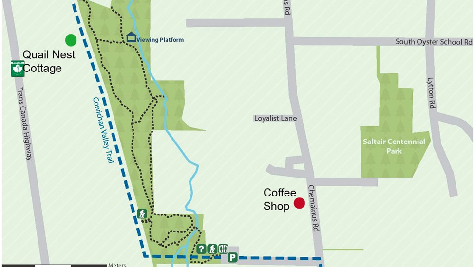
Trailhead right beside your cottage
Stocking Creek Park
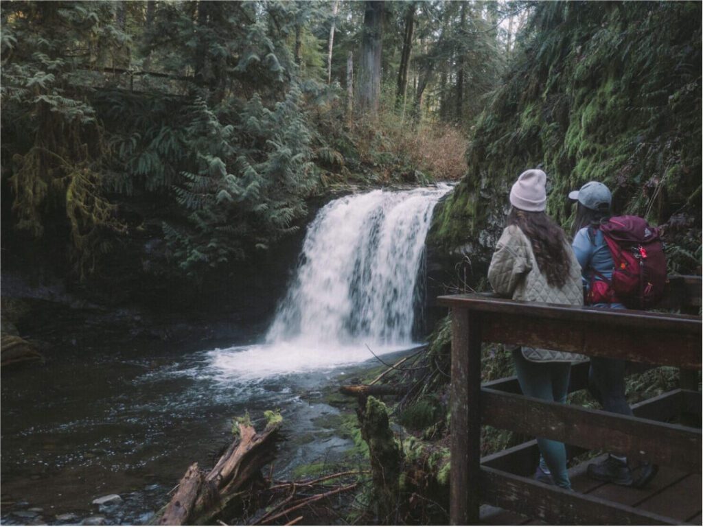
WALK/HIKE. Beautiful trails and a picnic area make Stocking Creek Park the perfect place for a nature walk. There are many trails meandering through the rainforest that lead to the creek and to the falls. If you continues to the south end of the park, take the bridge and follow the path through the parking lot, turn left on Chemainus Rd. A short walk to enjoy delicious baked good and refreshment at the Thanks A Latte coffee shack.
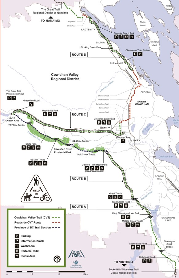
The Cowichan Valley (Trans Canada) Trail also runs through the park offering a connection south to Chemainus and north to the Town of Ladysmith.
To access takes steps behind your cottage, turn right of the abandoned railroad tracks. At the front of the property take the trail to the Trans Canada tails, about 70 metre south is the clearly marked park entrance.
Trailhead right beside the cottage
Cowichan Valley
[Trans Canada Trail]
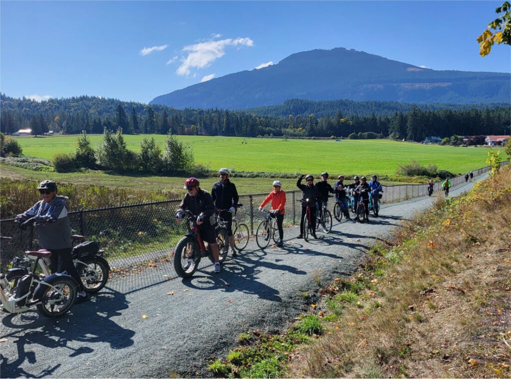
WALK RUN BIKE as far as you want! We like to ride our bikes to Chemainus to enjoy brunch or lunch. The Cowichan Valley Trail is a spectacular multi-use trail that is an integral part of the Trans Canada Trail route on Southern Vancouver Island. The Cowichan Valley section runs from the Capital Regional District boundary at the top of the Malahat, north to Shawnigan Lake and the Kinsol Trestle, west to the Town of Lake Cowichan then north to the Nanaimo Regional District.
The majority of the well maintained gravel trail is wide and flat with some sections running along the roadways. The trail provides for easy cycling and walking.
Trailhead 5 minutes from the cottage
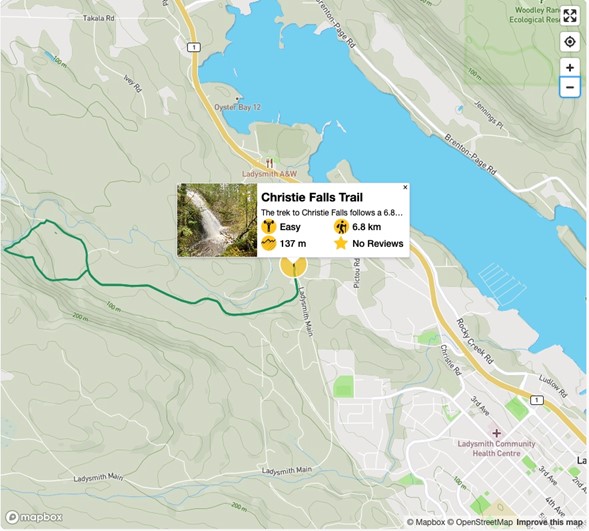
Christie Falls
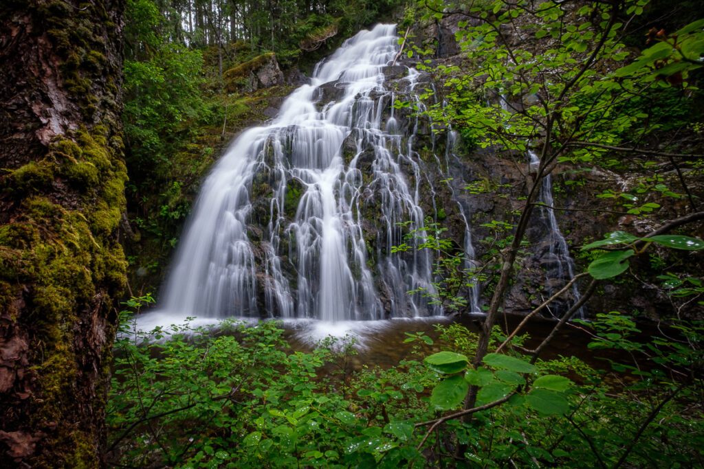
HIKE The trek to Christie Falls follows a 6.8 km lollipop hiking route just outside of Ladysmith, BC, that leads you through the rainforest to a scenic waterfall. Along the trail, you will pass by large mature trees as you experience the natural beauty and thick foliage of the West Coast temperate rainforest atmosphere before arriving at the cascading falls. This trail is perfect for a fun day of exploring the wilderness and is suitable for hikers of all skill levels.
The hike to Christie Falls is fairly straightforward; however, the route is poorly marked in some areas and might require a GPS or trail map for navigation, especially in the area around the falls themselves. Additionally, the route is well-maintained throughout the duration of the hike, but the upper portion to gain access to the falls is a bit steep and narrow in places. This might slow travel for some hikers, so make sure to come prepared with proper hiking footwear and poles if you think you might need them.
Although the majority of the hike will be through the dense cover of the temperate rainforest, this is an amazingly scenic hike that will truly make you feel as though you are on a proper adventure. As you work towards the falls, you will pass by giant trees and countless ferns scattered across the forest floor before crossing over some log bridges to arrive at the huge rock wall of Christie Falls with its torrent of rushing water. This is a great half-day hike that you’d be hard-pressed not to enjoy.
Setting out from the trailhead off Arroyo Road, make your way south along the road and follow the trail as it begins to veer toward the west. Here, the trail will enter into the thick cover of the forest and provide a nice amount of shade to hike under as you make your way toward the falls. You will gain a small amount of elevation as you hike along the route, and after 2.1km, you will come to a junction in the trail.
Head right and continue on for about 680 m to pass by the Bush Creek Fish Hatchery on your right and visit a beautiful wooden bridge that spans the rushing water of the creek. Don’t cross over the creek. Instead, turn back and retrace your steps for 100m to a junction on your right. Follow this trail on a path that runs parallel to the creek and will take you to the falls.
Keep steady along the trail for 450 m as it heads to the southwest and eventually arrives at the flowing water of the Christie Falls. This is not the end of your journey, however, so follow the trail closer to the edge of the creek and you will find a dark brown log bridge that will take you over the water and up toward the larger waterfall that is the main attraction of the hike.
After making your way up this slightly steeper portion of the trail, you will be greeted by some amazing views of the cascading water of the falls that trickles down the face of the rock and crashes into the pool below, giving the appearance of a bridal veil. After taking in the views, head back down the trail and cross back over Bush Creek.
About 70m from the bridge, you will come to a junction in the trail that offers an alternate loop back to the trailhead. Take this path to the right and follow it for about 700m through the dense canopy of the temperate rainforest to arrive back at the main trail. Take the main trail to the right to head back to the parking area where you began your hike.
Trail Head 5 minutes from the cottage
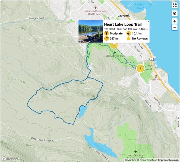
Heart Lake Loop Trail
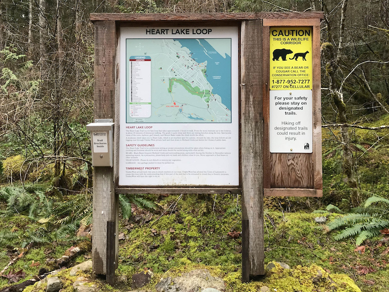
HIKE The Heart Lake Loop Trail is a 10.1 km lollipop hiking route in Ladysmith, BC, that climbs uphill along Holland Creek to arrive at the serene shores of Heart Lake. Along the trail, hikers will pass through amazing stretches of forest terrain and experience some beautiful views of the rugged Vancouver Island landscape
Although there are some steep sections along the trail, this route is largely made up of wide logging roads, making it perfect for casual hikers that are looking for a solid, intermediate length hike on the island.
Although this route mostly consists of old logging roads, the Heart Lake Loop is a fun hiking adventure that will allow you to experience some breathtaking views of Vancouver Island, as well as a peaceful lakeside setting where you can relax for the afternoon. Setting out from the trailhead off Methuen Street, follow the trail west as it skirts alongside Holland Creek and turns to the south. Reaching a junction in the trail, follow the path to the right to continue alongside the creek at the foot of a steep hill. This route will take you on a steep climb through the forest until you arrive at the tranquil shores of Heart Lake. Take some time to relax by the calm water and take in the scenic views before completing the loop and descending back down the hill while taking in the stunning sightline across the island. After reaching the junction with the main trail, follow it to the right to head back to the parking area where you began your hike.
To reach the trailhead for the Heart Lake Loop from the Ladysmith Museum, drive southeast on 1st Avenue for 650 m and turn right onto Methuen Street. After 650 m, turn left to enter the parking area.
25 minutes from cottage
Jack Point & Biggs Park
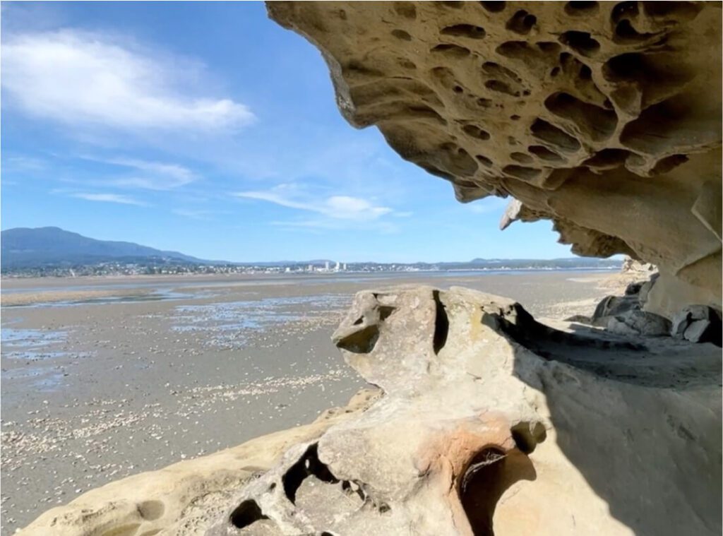
The park’s trail provides access to pristine beaches with excellent views of the Nanaimo River estuary, downtown Nanaimo, Protection Island and Gabriola Island. Popular for wildlife viewing; bald eagles, sea-lions, seals and even harbour porpoises can be seen from the park. Jack Point is an amazing location to watch the sunset.
Most of the 32 acre park is natural and undeveloped with a trail leading from Biggs Park to Jack Point. The trail is mostly chips but there are some stairs and boardwalks over the bluffs. The loop from the parking lot to the tip of Jack point is 2.5 km. This parcel of parkland runs parallel to the Duke Point ferry highway connector. Designated parking is found at the end of Jackson Road, and the pedestrian tunnel us then used to access the park.
PARKING NOTE: Please park at 655 Jackson Road (not along Duke Point Highway), you will need GPS for this one…
20-25 minutes to the water taxi
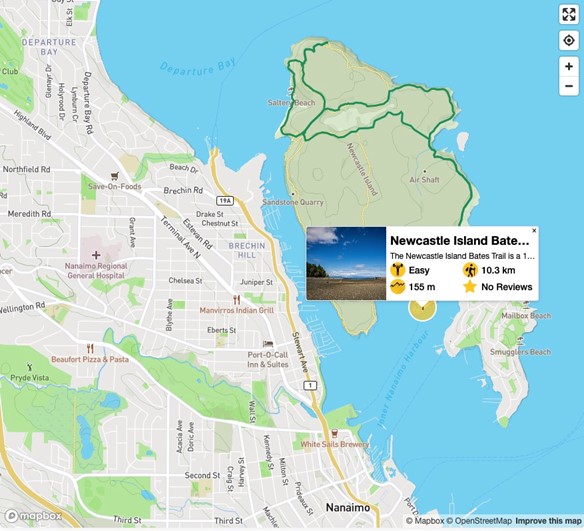
Saysutshun Marine Park [Seasonal]
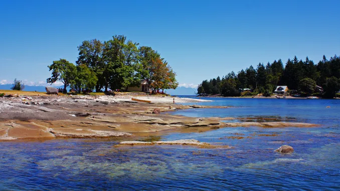
WALK HIKE The Newcastle Island Bates Trail is a 10.3 km lollipop hiking route just off the coast of Nanaimo, BC, that will take you through beautiful forests and along breathtaking coastal terrain for views looking out across the Strait of Georgia. To access the trailhead, hikers will need to take the ferry over to Newcastle Island, from which point they will be able to explore its many trails to their heart’s content. This route follows well-maintained trails that are easy to navigate, making it a perfect option for hikers of all skill levels, including families.
Due to the fact that you need to cross over to the island via ferry, the Newcastle Island Bates Trail is a fun, multi-faceted adventure that is sure to be loved by all.
Upon departing the boat, make your way northeast along the trail and hike along the edge of the coast for some beautiful views overlooking the Strait of Georgia. Reaching a fork in the trail near Kanaka Bay, take the path to the left to begin the loop portion of the hike that cuts across the interior of the island. Along this stretch, you will pass by the serene waters of Mallard Lake before exploring the west coast of the island along Roga beach.
Continue heading north to visit a scenic viewpoint at Giovando Lookout, where you can gaze out across the coastal landscape before once again cutting across the interior island, this time along the northern shore of Mallard Lake. After working around the eastern portion of the island and arriving back at Kanaka Bay, follow the main trail south to return back to the ferry terminal where you began your hike. There is a beach style restaurant and ice cream bar to reward yourself in after your walk!
To reach the trailhead for the Newcastle Island Bates Trail from Nanaimo, hikers will need to utilize the scenic Newcastle Island water taxi ($9 round trip) to cross over to the island where the trail begins.
35 minutes from your cottage
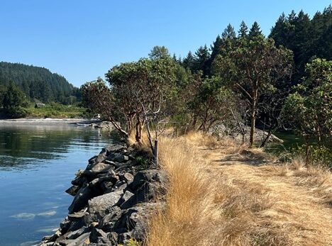
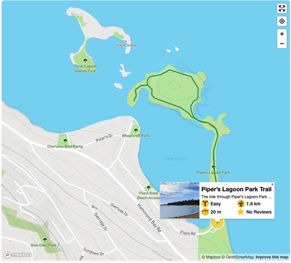
Pipers Lagoon Park
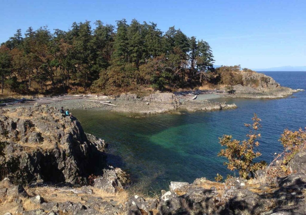
WALK HIKE Further afar but worth the drive. The trek through Piper’s Lagoon Park follows a 1.8 km lollipop hiking route in Nanaimo, BC, that travels along the coast for some amazing views across the Strait of Georgia. Along the trail, hikers will be able to relax in the wonderful coastal atmosphere with a chance to spot local wildlife like seals and various species of birds. While the trail is family-friendly, it is also a bit rugged, which might make travel difficult for less mobile hikers or families with strollers. In season it offers a nice swimming beach.
Piper’s Lagoon Park is an awesome hiking route in Nanaimo that will take you right along the edge of the water to enjoy the picturesque views of the coastal landscape and a variety of wildlife that can be found in the area. The trail is fairly flat and easy to navigate; however, there are some rocky portions that might make travel difficult for some hikers. Additionally, there is a large parking area that can be found right at the trailhead, but this can become busy during peak times. Try arriving early to enjoy the trails without the crowds.
The trail sets out from the parking area and heads north along a well maintained path that is flanked by the lagoon on the left and the Strait of Georgia on the right. As you work your way through this narrow stretch of land, take some time to enjoy the calm beauty of the coastal landscape. Arriving at a junction in the trail, take the path to the left to enter into the trees and make your way along the edge of the water. Completing this hike during low tide will allow for easier exploration, but the trail is still wonderful during all times of the day. Continue along the northside of the trail loop to explore the rocky parts of the coast where you will often spot seals basking in the sun. Once you arrive back at the initial trail junction, head straight through to return back to the parking area and complete your hike.
To reach the trailhead for Piper’s Lagoon Park from Nanaimo, drive northwest on Departure Bay Road for 1.9 km and turn right onto Hammond Bay Road. After 3.2 km, turn right on Lagoon Road, followed by another right in 67 m onto Place Road. Follow this for 500 m to arrive at the trailhead.
10-minute bike ride/20-minute walk from cottage
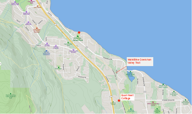
Gourlay-Janes Park
WALK BIKE SWIM A short hike through a forest leads to a beautiful open space bordering the Ladysmith harbour. This park is located on Chemainus Road. Dogs are permitted off-leash.
On a hot summer day an ocean swim sure feels nice! We often ride our bikes to the park mid-afternoon to enjoy both a refreshing swim and views of Ladysmith Harbour. A small park, it’s a bit of a local secret, often we have it to ourselves. Steps down straight into the water at high tide. The sea floor is a mix of silty and small rocks, water shoes or sandals are recommended. Good beach combing at low tide as well.
If driving, keep you eyes out, it’s easy to miss, note that parking is limited.
Note on the map there are four other beach access points, they offer great beach combing and views at low tide but are less suitable for swimming as they are rocky.
20 minutes from cottage
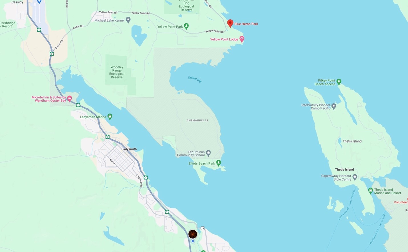
Blue Heron Park
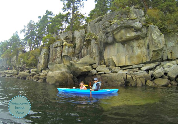
WALK BIKE SWIM KAYAK Blue Heron Park is a hidden gem in Yellow Point. Not well advertised w/ signage and only about 10 parking stalls. It has picnic tables on an amazing grassy area w/ a fab ocean view. Clean port-a-potty. Covered picnic area where the roof has been built around 2 fir trees. A great place to launch kayaks.
CVRD describes this park as:
Blue Heron Park is a great place to spend the day picnicking, swimming, or just walking along the beach. This park is in North Oyster off Yellow Point Road and has plenty of day-use parking.
A great place to bring a book or a bevy and a camp chair and get in some zen beach time!
20 minutes from cottage
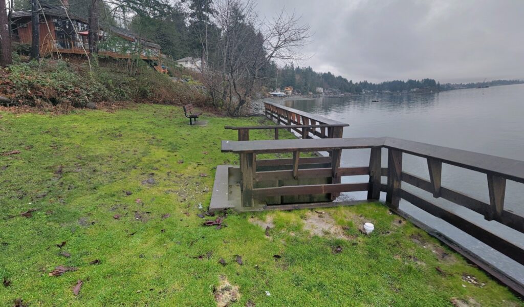
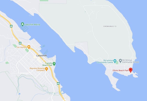
Elliots Beach Park
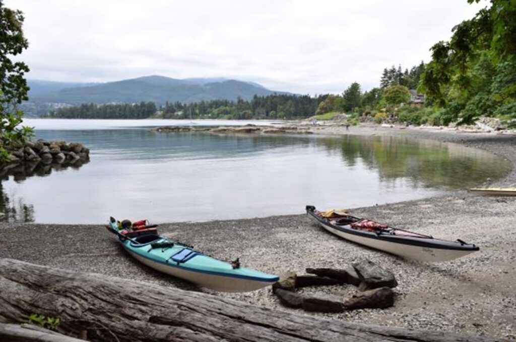
WALK BIKE SWIM KAYAK SCUBADIVE – A short drive to the other side of Ladysmith harbour brings you to the picturesque Elliot Beach. This is a favourite hangout spot for families to swim, picnic and just hang out. Excellent beach combing at low tide and a good kayak launch point, very popular with divers.
15 minutes to ferry from cottage
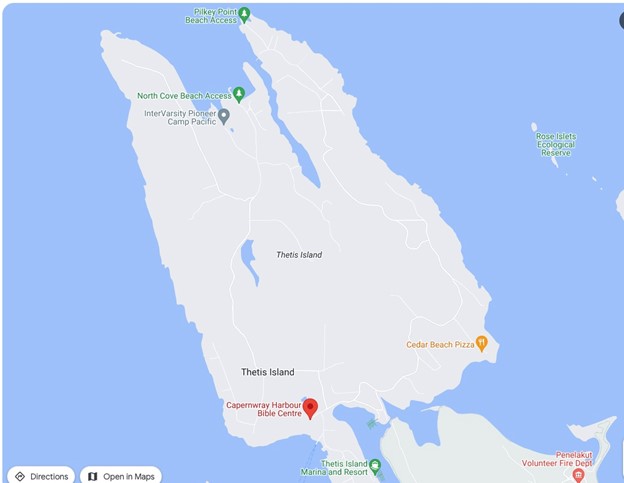
Thetis Island
BIKE WALK SWIM A relaxing retreat, especially popular in the summer, the approximately 350 permanent residents of Thetis Island welcome visitors to enjoy the diverse recreational opportunities, including scuba diving, fishing, swimming, boating, cruising and kayaking. On land, beach exploration, bird watching, and hiking attracts visitors to the island.
Thetis Island is mainly forested, with some farmlands, meadows and wetlands. There are no parks, but there are many public access points to the oceanfront and the easily hiked western shoreline. In summer Pilkey Point is an amazing swimming beach with gorgeous views. North Cove is a beautiful walk. Local facilities include a marina side pub and restaurant, a general store serving ice cream and two marinas. From the Cottage Thetis is a good day trip by bike, riding from the cottage on the Cowichan Valley Trail to the ferry at Chemainus (check the ferry schedule when planning!). The ride on Thetis on paved quiet rural roads however for most is best done on E-bikes as there is some quite steep parts.

